Similar Projects | All Projects for Client
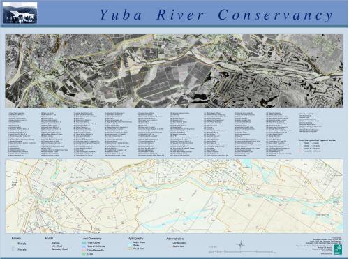
Combining aerial images, basic mapping and property owner information in one poster is very useful for land trusts. This project was a creative approach to combining all of that in one large poster map.
Based in the Foothills of California's Sierra Nevada, the Yuba River Conservancy was seeking a map that could inform its assessment of conservation land opportunities. GreenInfo developed the idea of a "two-track" map that showed basic geography coupled with an aerial image, where both maps had overlays of parcel ownerships coded to a list in the center of the poster. The final map was 48" wide and has basic branding to match the land trust's graphic identity.
Results: The map of properties and river frontage was used to assess properties for acquisition potential.
Focus: Conservation
Services: GIS Services, Maps
Tags: California, Esri ArcGIS, land trust, Yuba River
Project Years: 2003