See This Project | Similar Projects | All Projects for Client
GreenInfo contributed maps to two graphic posters that highlighted the Committee for Green Foothills' accomplishments and the key challenges to open space in its area of operation in the Southbay of the San Francisco Region.
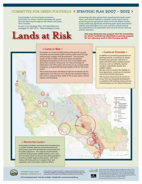
The Committee for Green Foothills has an illustrious history of work for land conservation and sound urban planning in the areas west of Silicon Valley, starting 20 miles south of San Francisco. To accompany their new strategic plan they developed two posters, one highlight conservation accomplishments and this one, showcasing the remaining threats to the open space of their region. GreenInfo worked with the Committee's graphic designer to insert maps into each, drawing from key datasets on protected areas and lands at risk, developed with the Bay Area organization, Greenbelt Alliance. Going beyond just GIS into broader communication efforts is a key tenet for GreenInfo and this project, while note major one for us, was a pleasure to be able to contribute to. The posters were displayed at various events and the visualizations used in different brochures.
Results: The two posters helped support the Committee's education and fundraising efforts.
Focus: Conservation, Environment
Services: GIS Services, Communications, Graphic Design, Maps, Cartography
Tags: Bay Area, California, Esri ArcGIS, graphic design
Project Years: 2002