Similar Projects | All Projects for Client
The Resources Law Group supports a wide range of innovative and effective conservation strategies and programs, frequently partnering with GreenInfo Network on projects including an assessment of landscape conservation of key viewsheds in a part of the San Francisco Bay Area.
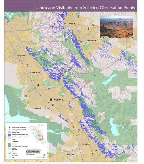
The western hills of Alameda County California have been the site of major conservation acquisitions to conserve impressive scenic beauty, maintain biodiversity and ranching, and to forestall inefficient suburban development.
GreenInfo Network was asked to develop an assessment of showing specific areas of these dramatic hills that were most visible from the urban areas of the region. Using Esri's Spatial Analyst software, we defined a series of observation points and then calculated the exact areas of the hills that could be seen from them, combining the results into a coverage showing all the lands visible from any of the points. This analysis was used to inform conservation acquisition options for this region.
Focus: Conservation
Services: GIS Services, Analysis, Data
Tags: California, Esri ArcGIS, Viewshed
Project Years: 2004