Similar Projects | All Projects for Client
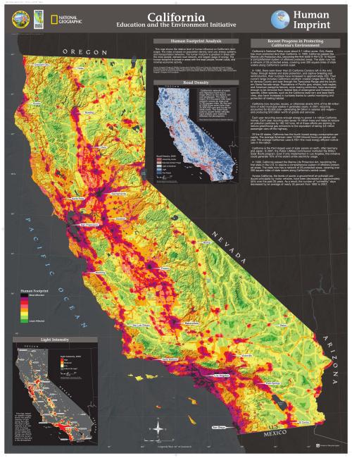
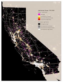
The National Geographic Society (NGS) is well known for its fine mapping which is why California asked them to contribute to an environmental education curricula. For one map in that series, NGS asked GreenInfo to prepare an illustration of lights in the California night sky.
GreenInfo staff researched global data on lights visible at night (tracked by satellite) and found the most reliable time series information, showing differences in the night sky from 1993 to 2000. Using the data, a detailed comparison map was prepared, for inclusion in a major poster (20mb PDF) in the California Education and the Environment Initiative.
Focus: Education, Environment, Government Agencies
Services: GIS Services, Data, Maps, Cartography
Tags: curriculum, Esri ArcGIS, light pollution
Project Years: 2008