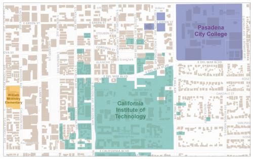
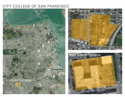
The 2018 release of the California School Campus Database (CSCD) now includes 115 community colleges and their 267 satellite campuses.
CSCD is a GIS data set containing detailed polygons defining the campus boundary of all kindergarten through 12th grade public schools, community colleges, and major universities in California. The boundaries define land used for educational purposes.
The addition of community colleges allows data users to identify each satellite campus a community college operates, along with information about off-campus lands such as open space, parking, and student housing.
It is available for free and downloadable in a file geodatabase, or as a or ArcGIS online service.
Focus: Education
Services: GIS Services, Data
Tags: CSCD,
Esri ArcGIS,
GIS data,
mapcollaborator,
schools
“
You are helping our dissemination and research aims. Thank you!”
— Lisa Henriksen, Senior Research Scientist, Stanford Prevention Research Center
Project Years: 2018