See This Project | Similar Projects | All Projects for Client
The Delta Stewardship Council has the tough job of creating a plan for this critical region of California that will balance biodiversity needs with water uses for people. The Council asked GreenInfo to provide assistance in helping them develop stronger map elements in the forthcoming plan, as well as assistance in overall graphic design.
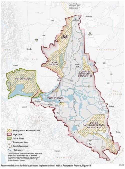
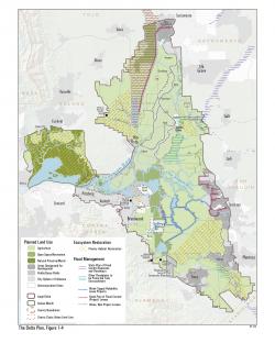
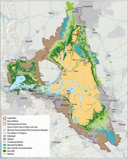
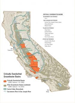
The focus of GreenInfo's mapping work was on creating page size map images for the Council's California Delta Plan. GreenInfo staff developed 20 maps, starting with a carefully designed set of cartographic conventions which aimed to make very clear the point of each map to a casual reader, and then draw them in with more information that becomes apparently after that first "grab". Our principle was to simplify each map to just its most basic needed elements and then carefully show them in an artful but technically accurate picture.
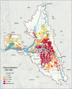
The maps cover a wide range of scales and topics - from statewide views to details of land subsidence in the Delta. Some maps were very general, others had to convey very large amounts of detailed information deemed important by the Council. At somewhat smaller than the size of a standard book page, these maps required careful cartography to enable readers to see the most important information first.
The maps were part of a larger project to assist the Council with the overall design of the Delta Plan, including layout, branding and charts and graphics. Learn more about GreenInfo's work on this project »
Results: The Delta Plan with its GreenInfo maps was published in late 2013 and is being actively implemented - the maps are guiding certain aspects of the Council's regulation and oversight of projects in the Delta.
Focus: Conservation, Environment, Government Agencies
Services: GIS Services, Maps, Cartography
Tags: California, Delta, Delta Council, Esri ArcGIS, visualizations
Project Years: 2011-2013