Similar Projects | All Projects for Client
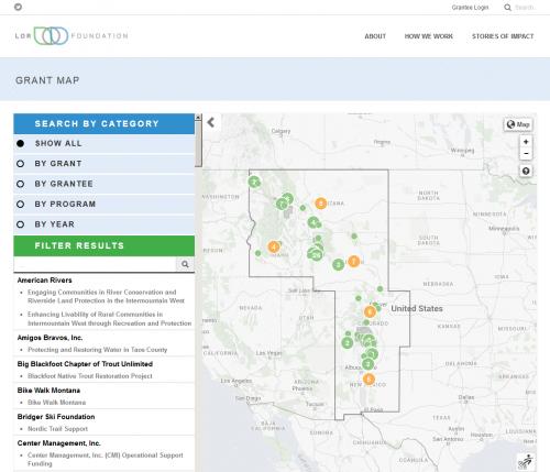
The Intermountain West is the regional focus of the LOR Foundation. The foundation aims to support community-driven solutions that enhance livability in their focus area, and makes grants to organizations and communities, in partnership, to carry out this mission. LOR asked GreenInfo for mapping support to help its staff visualize issues and places – we created print maps and an interactive layer browser - but the foundation also wanted to have a visual storytelling feature of their grant locations to viewers of their web site.
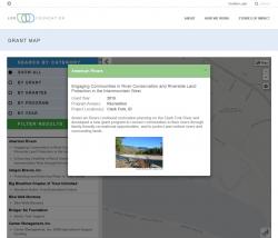
The grant mapper has two elements:
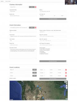
1. ADMINISTRATION: An administrative interface lets foundation staff and consultants enter information about each grantee and each grant, including the location(s) of the grant, along with descriptive information and a media (mostly photo) file. This system has a very user friendly geocoder that searches first for the center point of any grant location (e.g., Seely Lake MT), but allows the user to then move it on the map to a more precise location. Grants can have dot locations in multiple areas (these are often not highly place specific but centerpoints of towns, counties or states).
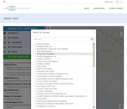
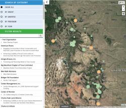
2. GRANT MAP: An interactive map provides LOR website visitors with a range of visualization options. Grants can be searched by name, by grantee, by year and by program, and searching within a categorical selection by text filter is also provided. The map itself allows for seeing more information on individual grants through a popup. Grants are clustered where more than one is in the same location - clicking on a cluster splays out the component grants for further inspection.
The grant map is resizable to phone screens, though map applications always have challenges at these screen sizes - this one works reasonably well, and remains very fast.
The technology in this application uses Leaflet as the mapping API, with grants displayed as GeoJSON points pulled from a PostgreSQL database.
Focus: Economic Development, Environment, Philanthropy
Services: Interactive Solutions, Applications Development, Web Mapping, Mobile Applications
Tags: foundation, grantees, grants
“ Working with GreenInfo on the creation and development of this interactive map was truly a great experience. LOR had a vision - how can the foundation use technology as a storytelling tool to profile our grant making, while also effectively illustrating the various places, communities and organizations we have partnered with throughout the Intermountain West region? The result of that vision – the creation of the LOR Grantee Profile Map – is currently serving as a useful interactive tool for audiences to better understand the impact of our work, identify the numerous organizations that helped in facilitating that work and the communities we’ve partnered with to foster change through solutions activation. ”
— LaMonte Guillory, LOR Foundation Communications Director
Project Years: 2015-2016