See This Project | Similar Projects | All Projects for Client
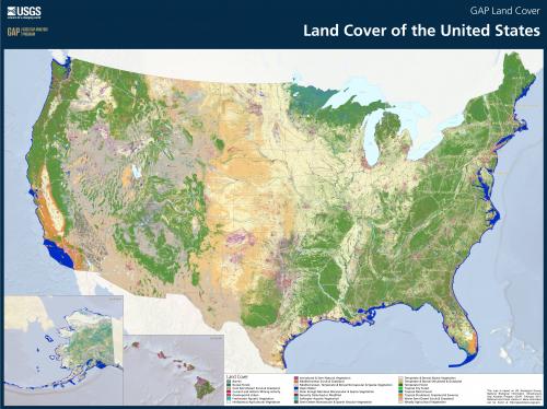
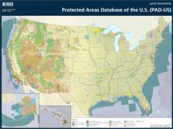
Visualizing large data sets that cover the entire U.S. is important to conveying the significance and "grain" of such data. GreenInfo has long worked with the USGS GAP and was asked to develop poster maps for two of its leading data sets - land cover, and protected areas.
These large poster maps use a general design style that GreenInfo developed for the USGS Gap Analysis Program (GAP). One poster depicts the protected areas of the U.S., coded by type of land owner, and drawn from the GAP Protected Areas Database of the United States (PAD-US). This GIS inventory covers almost a billion acres of federal, state and in many areas local protected lands and is constantly being updated and improved through GAP's efforts to build capacity in each state to manage such data (in California, GreenInfo's CPAD data is the state's element in PAD-US).
The second poster shows GAP's Land Cover data set, which is depicted with a generalized classification of vegetation - the full data set allows for mapping very detailed land classifications.
Focus: Conservation, Government Agencies
Services: GIS Services, Maps
Tags: Esri ArcGIS, land cover, PAD-US, Protected Areas, USGS GAP
Project Years: 2013