Similar Projects | All Projects for Client
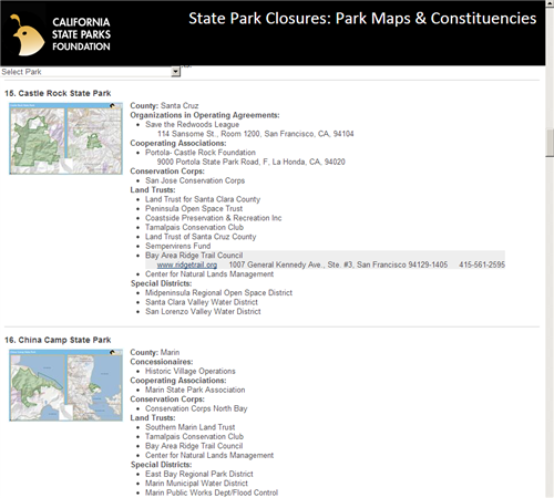
The threat of closures of California state parks led the California State Parks Foundation to search out partners near parks who could be activated to support or even take over park management at some sites. GreenInfo worked with the foundation to create a web based tool that enabled them to quickly see who might partner at each of the scores of parks potentially slated for closure.
We wanted to condense troves of spatial information into a one-stop product that's easily accessible.
The constituency/stakeholders included groups such as
- Organizations in Operating Agreements
- Cooperating Associations
- Conservation Corps
- Land Trusts
- Special Districts (Park Agencies)
- Concession vendors and other miscellaneous interests.
The boundaries of the parks themselves are well known, but the boundaries of the above groups were known to varying degrees: some have areas showing sphere-of-influence; some have point locations of headquarters; some had no known geography, but were related to their associated park in a simple table.
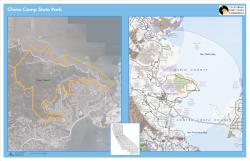
We used ArcGIS to spatially join a buffer of each park to the constituent groups. We created a map template for a representative park and used Data-Driven Pages with autolabeling to quickly export a map for each of the 70 parks.
Instead of delivering the results as multiple spreadsheets or 70 pages of maps with scattered labels, we formatted the data into a web page with collapsed/expandable contact details and web links. Since we needed the joined attributes but not the geometries, we used the open-source OGR tool to quickly convert to web-friendly javascript. We display a thumbnail map for the park, which expands to a fullscreen map showing a locator map and two views of the park and surrounding data. V
Focus: Conservation, Environment
Services: Interactive Solutions, GIS Services, Data, Applications Development, Web Mapping
Tags: California, Esri ArcGIS, gdal/ogr, parks
Project Years: 2011-2012