Marin Resource Conservation District (RCD) worked with GIN in developing and implementing a robust new GIS system. Over several months we did monthly training for ArcGIS Pro and data management. Collaboratively we consolidated and updated existing data into organized geodatabases. We created templates for their Carbon Farm Plan maps and a style file symbology for consistency across the program. Lastly, we created a GIS Best Practice guide that highlighted the new data structure, templates, styles as well as key functions performed by Marin RCD GIS staff.
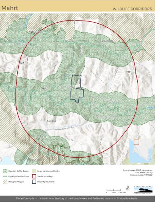
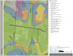
The template designs for the Carbon Farm Plans were designed to create a consistent look and feel across the program as well as aid in efficiency when making new maps. Marin RCD wanted the look to reflect the colors of their logo. We created several sizes, orientations and various layouts to accommodate more or less text.
All previous mapping at Marin RCD was in ArcMap. We moved the entire system into ArcGIS Pro and merged shapefiles into organized geodatabases.