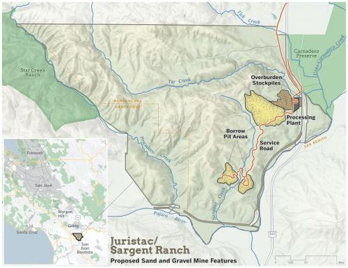
We created this map to help advocates, including the Committee for Green Foothills and the Amah Mutsun Land Trust, fighting against the approval of a sand mine on lands sacred to the Amah Mustun tribe.
The quarry site includes a ceremonial site and several sacred mountains. The larger Sargent Ranch is also, as shown on the map above, a potential linkage across the Santa Cruz Mountains between Carnadero Preserve and Star Creek Ranch. According to the Peninsula Press, The land is owned by a company called Debt Acquisition Company of America, which bought it in 2013 and now argues that sand mining here is limited to a small footprint and the rest of the ranch would be conserved. The property is one of the first in Santa Clara County to be subject to Assembly Bill 52, a 2014 law designed to give added protection to sites sacred to Native tribes.
Focus: Environment, Social Justice/Equity
Services: GIS Services, Maps, Cartography
Project Years: 2019