Similar Projects | All Projects for Client
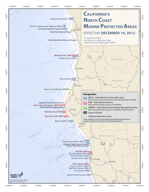
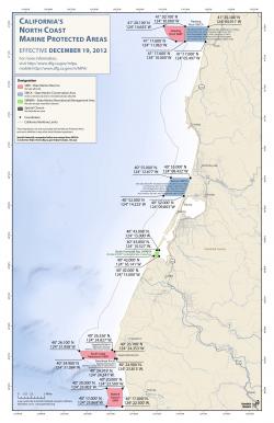
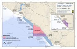
As part of GreenInfo's work with Ocean Conservancy on California's Marine Life Protection (MPA) Act, we have prepared a wide range of regional and statewide implementation maps for public education.
Thousands of copies of GreenInfo's maps, produced with Esri's ArcGIS software, have been distributed throughout California's coast, displayed at state beaches and given away for free at bait shops. In an effort to familiarize the public with marine protected areas and describe locations and regulations, these maps are essential to the success of the MPA implementation process.
Focus: Conservation, Environment
Services: GIS Services, Maps
Tags: California, Esri ArcGIS, Marine, Marine Protected Areas, MLPA, MPA, Ocean
Project Years: 2006-2013