See This Project | Similar Projects | All Projects for Client
The Commission on Environmental Cooperation (CEC), a joint agency of the U.S., Canada and Mexico emerging from the NAFTA trade agreements, focuses on improving environmental conditions in North America. The CEC is known for assembling important spatial data and asked GreenInfo to be its partner to develop a web application that could make this information more publicly accessible.
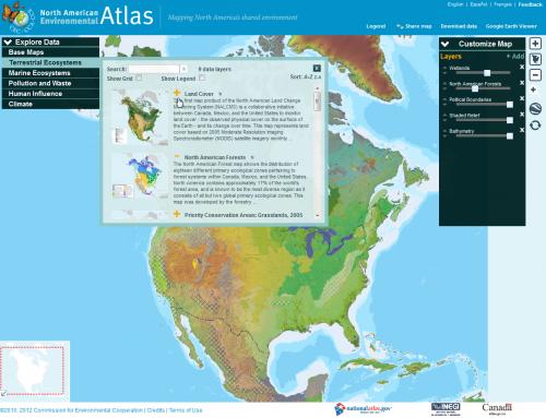
GreenInfo Network built this custom interactive mapping application to showcase the dozens of important data sets available through the Commission on Environmental Cooperation (a joint agency of the U.S., Canada and Mexico) concerning environmental conditions in North America. A basic map view is supplemented with a 3D option using Google Earth technology. Each data layer can be displayed and downloaded, and descriptions and legends are easily available. Sliders allow adjustment of the transparency of each layer for visual clarity. Recently added features include intuitive map customization options for reordering map layers, map sharing link that captures user's customized map for emailing to others, searchable data catalog, and a bulk data download tool.
Focus: Conservation, Environment
Services: Interactive Solutions, Web Mapping
Tags: atlas, canada, CEC, environment, Google Earth, mexico, north america, united states
Project Years: 2009, 2010, 2011, 2012