Similar Projects | All Projects for Client
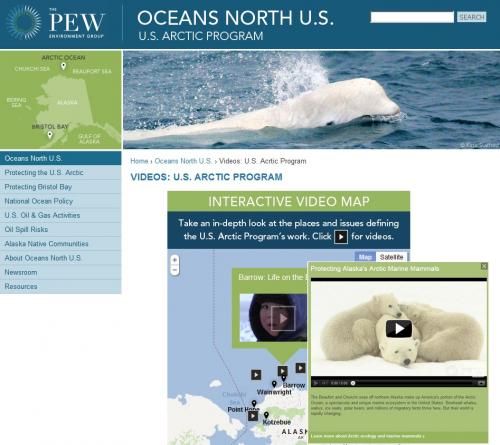
Pew's U.S. Arctic Program developed a series of videos that illustrate the issues, wildlife, and people that life along Alaska's coast - GreenInfo made an interactive map as a point of point of entry to those stories.
The Pew Arctic Program mission is:
"We promote science-based decision making for America’s Arctic Ocean – the Beaufort and Chukchi seas off Alaska’s north coast. This includes making sure that biologically important areas are protected from development and that indigenous communities are involved in planning efforts. We also work to ensure that, if offshore development occurs, it is in the right place, at the right time, with the right, Arctic-tested oil spill prevention and response measures in place. In addition, we promote permanent protection for Bristol Bay and its world-class fisheries in the Bering Sea off southwest Alaska."
Focus: Conservation, Environment, Philanthropy
Services: Interactive Solutions, GIS Services, Cartography, Web Mapping
Tags: Arctic, Google Maps API, Ocean, Pew Trusts, YouTube
Project Years: 2012