See This Project | Similar Projects | All Projects for Client
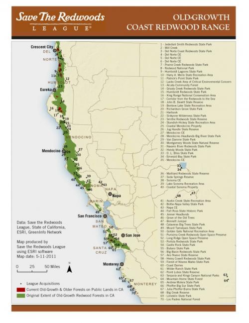
We have provided maps for printed reports and webpages for Save The Redwoods League for many years. This particular project mapped proximity of current and original extents of old growth coast redwoods to protected lands.
We designed this map with Esri's ArcGIS software, applying fonts and colors directly from Save The Redwoods League's (SRL) organizational style guide. This allows a consistency between map and website and continues the branding efforts that SRL has established. The resulting map is a simple illustration of change in the coast redwood's range over the years and the vast number of protected areas that dot the landscape through the tree's historical range.
Focus: Conservation, Environment
Services: GIS Services, Maps
Tags: California, Esri ArcGIS, Redwoods
Project Years: 2011