See This Project | Similar Projects | All Projects for Client
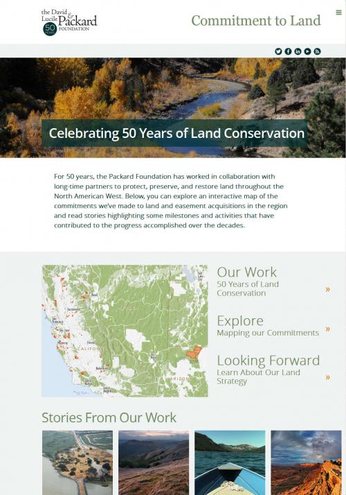
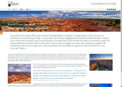
Since 1964, The Packard Foundation has helped protect almost three million acres of habitat and other natural lands, all over the western United States. To help commemorate the 50th anniversary of this tremendous investment of resources, the foundation asked GreenInfo to create a tracking system for its land acquisitions and a web site to showcase them and key stories about the foundation's conservation work.
The project proceeded in three phases:
1. DATA PREPARATION
Tracking 50 years worth of land acquisitions is complicated, particularly since GIS data on these was mainly available from the mid-1990s on. Staff at Resources Legacy Fund and the foundation did extensive research and compiled a list of acquisition grants, along with associated PDF and paper maps. Greeninfo took this information and matched much of it to its own GIS data files on foundation grants and grantees, and then refined the attributes and shapes of the acquisitions. We also digitized many lands for which there were only paper maps, and worked with grantees to find specific information on their grant results. All of this data was then assembled into a composite GIS data file, covering 150 grants that totaled 2.7 million acres of land, mostly of it land protected by conservation easements. Further foundation review refined the attributes about these grants (name, type, date, etc.).
2. SITE DESIGN AND DEVELOPMENT
At the same time as the data work began, GreenInfo worked with the foundation to clarify site objectives, explore examples of related sites and develop a design framework for the new site, which was to be a "microsite" within the Packard.org web site. This work included mockups of the mapping element (below) and sketch concepts for how the main site would work, focusing on user needs and foundation communication objectives.
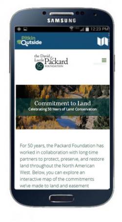
The next phase was to develop wireframe images of how content might be arrayed on pages. After early drafts of these were okayed, GreenInfo's longstanding design partner, Ison Design developed more refined images of page layout, including a responsive mobile layout for tablets and phones. These designs were then reviewed and approved by the Packard Foundation.
Finally, we researched appropriate technical approaches for the site development since it would live on the Packard web site. We settled on using WordPress, and then began developing the site. At the same time, Packard staff refined content about themes to be highlighted ("Stories" on the final site), and GreenInfo integrated these into the site, using special WordPress themes that reflected the site design.
3. MAPPER DESIGN
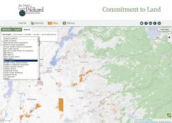
A key feature of the entire effort was interactive mapping that would show lands protected and allow users to do basic searching and information discovery. GreenInfo started by quickly developing a web map prototype to browse data and explore function options, and then engaged Packard staff in reviewing this. With the feedback, GreenInfo developed more a more detailed wireframe showing the layout of the map features, and then proceeded to further development.
After reviewing options that allowed Packard to maintain not just the narrative content but also the geographic information, GreenInfo choose to use the CartoDB platform. This allows the foundation to adjust property attributes easily, though adding new lands still requires bringing in that geographic shape data through GIS techniques.
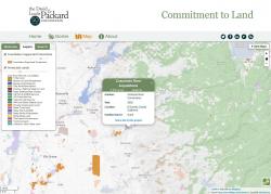
The mapping page was given search and legend tabs, as well as styled popup boxes and navigation controls. Users can choose to browse a grant (property) list of grantees or types or years, with options to zoom into any one of them. It also provides the capacity to share a link to any particular acquisition.
LAUNCH!
GreenInfo worked with various levels of Packard staff to ensure the site design and content met their needs - narrative text, photos, layout and the mapped elements all needed fairly extensive review. The Land Map site was announced in mid-Feburary 2015 in a letter from the Packard Foundation's president.
Overall, this project resulted in a bright, responsive and efficient depiction of an amazing record of conservation accomplishment. Having itself been part of that track record, GreenInfo is proud to have helped provide a public record of what was done over 50 years.
Results: The web site launched in February 2015 and has been featured by the Foundation in its public communications.
Focus: Conservation, Philanthropy
Services: Interactive Solutions, GIS Services, Data, Applications Development, Web Mapping, Website Design, Mobile Applications
Tags: Esri ArcGIS, responsive
Project Years: 2014-2015