See This Project | Similar Projects | All Projects for Client
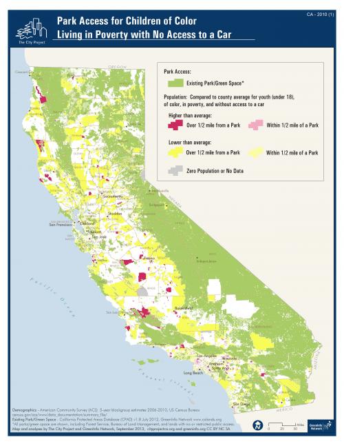
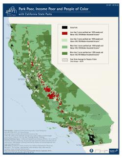
For over a decade, The City Project and GreenInfo Network have worked together to analyze access to parks and open space in California. Various methods and data sets have been used to give a more comprehensive view of the most park poor areas in the state.
For this project, a set of three statewide maps were developed to demonstrate the need for more parks in California. The maps are used to show the communities with the greatest need for additional open space and recreation opportunities.
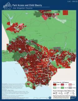
For many of the Southern California counties, The City Project has also developed reports documenting the unique characteristics of the area. Information on the local history, community, and local efforts are described in great detail.
Focus: Conservation, Environment, Human Services, Public Health, Social Justice/Equity
Services: GIS Services, Analysis, Data, Maps
Tags: American Community Survey, Census, CPAD, demographics, Esri ArcGIS, Los Angeles, open space, park access, park equity, Prop. 84
Project Years: 2001 - 2014, ongoing