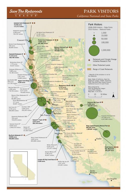
Save the Redwoods is focused on the range of California's great trees, many of which are protected in State and National parks. To demonstrate the level of public use of these parks, the organization asked GreenInfo to create a data-rich map to be used as reference in public engagement.
GreenInfo developed a poster map of park visitation that could also be printed and legible as a page size product. The key to the map was the very careful labeling work done to provide details on each of the park unit's visitor counts. The parks were symbolized with graduated circles, and the background range of redwood trees highlighted. GreenInfo's CPAD (parks and open space data) provided a general backdrop of all public lands. The overall branding that GreenInfo had developed from Save the Redwood's organization graphic identity created the frame for the map.
Focus: Conservation
Services: GIS Services, Maps, Cartography
Tags: California,
Esri ArcGIS,
parks,
Redwoods
Project Years: 2012