The new site is rebuilt from the ground up in the Django application framework, backed by Postgres, and the design is based on the State of California's new web design standard, which emphasizes all-access approaches to interface elements and color schemes.
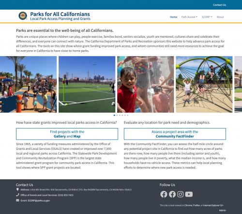
The home page foregrounds specific park projects and people who have benefited from them, while also providing immediate navigation to the two most important parts of the site:
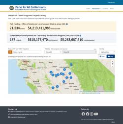
The Project Gallery, which allows you to search by project, program, or jurisdiction to see how public funds for local parks have benefited your community. Here, we present before and after photos and other basic information about grant projects, and you can search by city, county, or legislative district (assembly, state senate, congress). Dynamic project counts and values tell the overall story of impact in your community, while images from State Park Program projects tell the specific stories of people who have benefited from new park access.
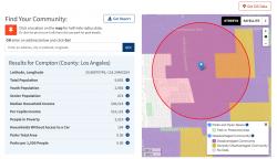
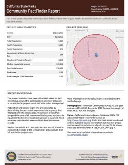
The Community FactFinder is the main tool used as part of the grant application process, providing an instant, easy, and consistent read on the demographics within a half-mile of any point in California. New "stateful" URLs make any view of the FactFinder easily shareable as a link while the PDF report generation tool creates a unique project ID and a well-designed demographics report for inclusion in grant applications.
The site also includes the Park Access tool, which gives a community level assessment of park need, and the Per Capita Income tool, which helps local agencies determine if they need to provide local matches for certain kinds of state park funds.
In addition to a full redesign and rebuild, this project included extensive and ongoing data and analysis work, including developing new methods to pull in data from the U.S. Census API, reviewing approaches to estimating population data, and maintaining a constant flow of edits to the underlying parks data (the California Protected Areas Database), in response to grantee updates of park locations in their communities.