See This Project | Similar Projects | All Projects for Client
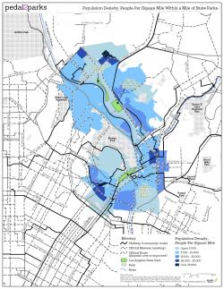
Frequent collaborator Jon Christensen, among other things a professor at UCLA's Institute of the Environment and Sustainability, engaged GreenInfo to design a series of print maps, posters, and a web map in English and Spanish to support the Pedal2Parks initiative, part of an international Bike!Bike! event held this year in Los Angeles in September 2018. To help increase the accessibility of the state parks along the LA River, Pedal2Parks combined data analysis and mapping by GreenInfo with community engagement and participatory design from Jon and Public Matters, a Los Angeles-based urban design firm.
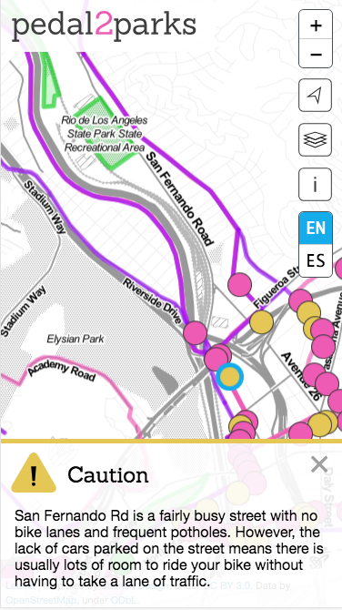
- Getting to the park, using a webmap, in English and Spanish, that included extensive community curated tips and special "Chillway" routes created by local cyclists recommending their favorite safe routes to the parks.
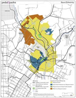
- Understanding who lives in and around the LA River State parks, with detailed population and demographic maps designed to be printed at letter size.
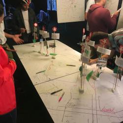
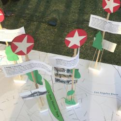
- Large scale posters, some 40 inches tall to hang on walls and one a full 96" long used on a table for event attendees to make their own notes and recommendations about improving safe routes to parks.
Focus: Recreation, Social Justice/Equity
Services: Interactive Solutions, GIS Services, Maps, Web Mapping
Tags: Esri ArcGIS
“ It’s really a pleasure to work with you and all of your crew.”
— Jon Christensen
Project Years: 2018