Similar Projects | All Projects for Client
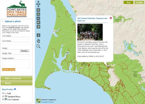
GreenInfo's simple web map application enables hikers to share their photos and experiences as they respond to the Point Reyes Trails Challenge.
To celebrate the 50th anniversary of the Point Reyes National Seashore, the Point Reyes National Seashore Association (PRNSA) held a Trails Challenge event where participants were invited on a self-paced exploration of 150 miles of public trails over 6 months to benefit the Seashore's trails and wildlife. In support of this effort, GreenInfo developed an engaging system where participants can share their photos and experiences from on the trails with others. Users of the application can upload and geotag photos, post comments about their hikes, and find information about trail locations and conditions.
Results: GreenInfo developed a web mapping application that enables Trails Challenge participants to document and share their experiences on trails of the Point Reyes National Seashore.
Focus: Environment
Services: Interactive Solutions, Applications Development, Web Mapping
Tags: California, Pt. Reyes, trails, web mapping
Project Years: 2012