See This Project | Similar Projects | All Projects for Client
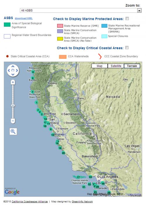
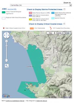
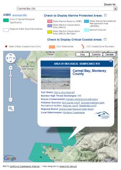
In 2010, the California Coastkeeper Alliance asked GreenInfo to help it compile an interactive map of critical marine ecosystems.
Using Google Maps JavaScript API v3 and a series of KML files, we prepared a map showing a series of marine protection layers, including areas of special biological significance, marine protected areas, state critical coastal areas, critical coastal area watersheds, and the California Coastal Commission coastal zone boundary. Custom infowindows were prepared to give additional details for each of the areas and link to local water board and Waterkeeper websites.
Focus: Conservation, Environment
Services: Interactive Solutions, GIS Services, Data, Web Mapping
Tags: California, coast, Google Maps API, Marine, MPA
Project Years: 2010