Public Access to Park Needs Data

Park Need by Study Area
Client:   County of Los Angeles (with Placeworks)

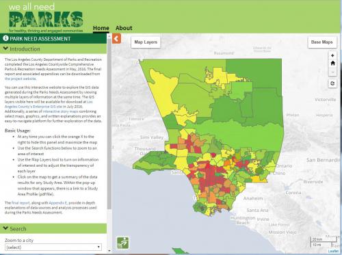
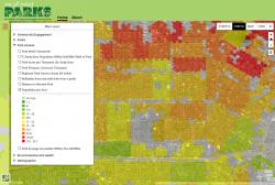
GreenInfo assisted the consulting group for Los Angeles County's massive parks need assessment, a story told in  We All Need Parks!  With the successful completion of this work, the County asked for a simple web map interface that would allow the public to look "under the hood" and inspect the data used in an assessment that showed billions of dollars of park needs.

Giving citizens access to information is critical for initiatives that might seek very large amounts of new public funding to help improve parks in one of the nation's very largest urban areas.  For the LA Park Needs Analysis, 30 different data sets were used for very complex geospatial analysis, and the public viewer had to be designed to both make it easy to see these and capable enough to showcase the quality of the data sets.

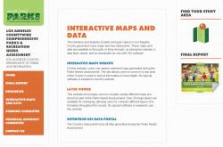
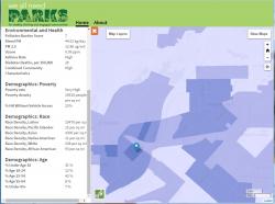
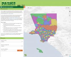
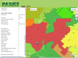
GreenInfo developed an interface design that fit with the needs assessment web site, calling it the LANA Viewer (Los Angeles Needs Assessment Viewer).  With data panels that slide in and out to allow for an uncluttered look, the application features layer choosing, ransparency adjustments, base map options, and reports on Study Area details, allowing non-GIS users the ability to browse and interact with the data in an easy to use application. 

Users can learn about a communities demographics (age, race/ethnicity, poverty rates, vehicle access, and population density) along with pollution exposure (California EnviroScreen score, diesel, ozone)  health (asthma rates, diabetes) and the community member's ability to access parks and recreation.

GreenInfo developed the user interface in ReactJS.  The map interface is written in Leaflet, and sports custom-written controls to provide a customized experience such as the built-in legends in the Map Layers menu.

The underlying map data is 340 MB in volume, across the 30 datasets. These are rendered, and click-query functionality is provided, using MapServer as a Web Map Service (WMS) back-end.


Results: Dissemination of the data for the public to interact with completed the We All Need Parks! project.

Focus:   Public Health, Recreation, Social Justice/Equity  

Services:  Interactive Solutions, GIS Services, Data, Web Mapping 

Tags:   California, CPAD, Los Angeles, park access  

Project Years: 2016

GreenInfo Network creates, analyzes, visualizes and communicates information in the public interest. We specialize in mapping and related technology for nonprofits and public agencies, focusing on using it for conservation, social equity, public health, environment and foundation grant making.
2201 Broadway, Suite M5
Oakland
CA
94612
United States of America