Recreational Trails Map for Aspen, Colorado

Full Trails Map for Aspen, Colorado
This 18"x24" trails map features topographic shading matched with land cover, giving it a realistic, but readable feel.
Client:   City of Aspen, Colorado

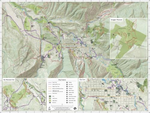
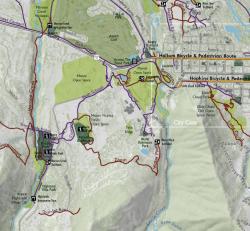
Aspen is a famous Colorado resort town nestled in a valley surrounded by incredible mountains. It has a large and actively used summer and winter trail system, but needed a good print map to help visitors and locals alike make good use of these resources. GreenInfo, as part of a related web project, was asked to create a new approach to their old trails map.

The City of Aspen is just under 10,000 residents, but it has world-class recreation around it.   An older trail brochure was due for updating and at the same time, Pitkin County (within which Aspen is located) had commissioned GreenInfo to develop a web-based trail finder and mobile application (learn more about this project).  The final map was refined using Adobe Photoshop and Illustrator and prepared as a publication-ready file.

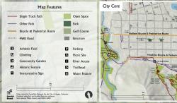
The City of Aspen developed the flip side of the map and printed 40,000 copies to be distributed to city visitors.

Focus:   Environment, Government Agencies, Recreation  

Services:  GIS Services, Communications, Publications, Maps, Cartography 

Tags:   Adobe Illustrator, Aspen, Colorado, Esri ArcGIS, parks, trails  

Project Years: 2014

GreenInfo Network creates, analyzes, visualizes and communicates information in the public interest. We specialize in mapping and related technology for nonprofits and public agencies, focusing on using it for conservation, social equity, public health, environment and foundation grant making.
2201 Broadway, Suite M5
Oakland
CA
94612
United States of America