Just over the East Bay hills from San Francisco Bay and south of Mt. Diablo State Park, the City of San Ramon has a remarkable system of parks, open space lands, and trails available to residents and visitors. These trails connect a diverse system of parks and preserves, from up in the surrounding hills down into the namesake valley where most of the town's residents live. When recreation planners in the town wanted to showcase these multi-modal trail links in a print map, they turned to GreenInfo Network.
GreenInfo has extensive experience in developing great trail maps and web applications, as well as managing the GIS data that goes into them. The City's trails committee knew the area's trail network intimately, but needed to share that information with the City's residents, along with their plans for future trail extensions.
As with all mapping projects, our work started with data validation. We had a mix of data in GIS and AutoCAD trails data from the City that was unusable to most of the trails committee, so our first task was to quickly turn that data into a simple map for expert review. They returned hand-drawn notes, adjustments to trail alignments, and other invaluable edits that greatly improved the accuracy of the map.
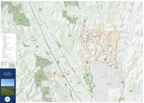
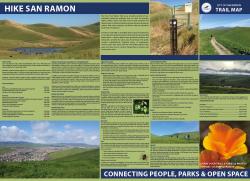
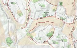
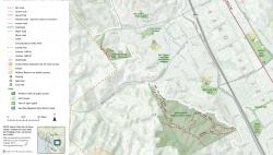
From this base of validated trails information, we turned to the task of designing the map itself. Using only Esri's ArcMap software, we crafted a data-rich, but highly readable cartographic framework for the map. The trails themselves were given a careful hierarchy of symbology, where color and line type accommodate all the many variations in trail and road types. Finally, we worked through a complicated hierarchy of label formats and symbols, each type designed to blend in with all the other map elements. As a final step, we customized the map frame grid in Adobe Illustrator. The City's Parks and Recreation team created the reverse side of the map with information about favorite trails, local flora and fauna, and safety tips.
The final printed map size is 36"x26", and it folds down to an easy back-pocket carrying size for use on the trails. This map beautifully demonstrates GreenInfo's insistence on its work being legible in "layers of meaning" - viewers should easily see relevant information at each distance from the map, seeing major features when looking at the entire map, and very detailed ones when looking close up, with all elements "visible" at their intended distance.
This map also demonstrates the power of the main GIS tools GreenInfo uses, where we can work with complex data to create beautiful, print-bound design.
Focus: Environment,
Government Agencies,
Recreation
Services: GIS Services, Communications, Graphic Design, Data, Maps
Tags: California,
Esri ArcGIS,
parks,
recreation,
trails
Project Years: 2017