See This Project | Similar Projects | All Projects for Client
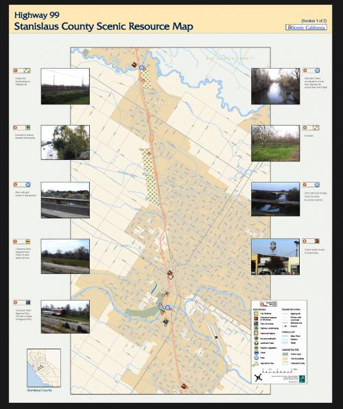
Scenic landscapes can include historical and cultural assets as well as beautiful views. GreenInfo Network developed a series of maps illustrating GIS data on such assets along the Highway 99 corridor of California, combining both data on geographic location with images of those locations.
Scenic California was an interim organization (now taken into Scenic America) promoting the importance of the visual quality of the landscape. This project was focused along Highway 99 in California's Central Valley. For each of several large sections of the highway corridor, GreenInfo Network developed GIS data identifying visual assets (developed by local partners from on the ground assessments) and prepared a series of maps similar to the one shown. The maps were used for presentations and working sessions devoted to developing strategies to protect scenic views and resources.
Focus: Environment
Services: GIS Services, Maps
Tags: California, Esri ArcGIS, scenic, scenic highway, Stanislaus County
Project Years: 2003