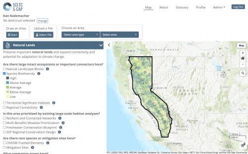
The Sierra Cascade Land Trust Council (SCLTC) covers a huge portion of California, touching all or part of 31 counties. So when they started developing a Strategic Conservation Action Plan, they needed a tool that would allow them to explore conservation opportunities at multiple scales across many different types of landscapes. The mapping application we built for them does just that.
To understand the various ways SCLTC member land trusts might use the tool, we engaged in a series of design research activities, drawing on surveys the SCLTC team had already done and then conducting interviews, developing journey maps, and designing our interface to meet the needs of land trust staff working on land acquisition, fundraising, and strategic planning.
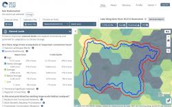
The tool itself reports on more than 40 data layers the SCLTC team developed with partners Geo5Designs, and allows for either custom area reporting or fast reporting of saved areas like counties, watersheds, and the service area of each land trust. During user research, we learned that land trust staff often need to know what's near their property as well as what's in it, so we added a dynamic buffer tool that allows for up to a five-mile buffer around a selected area.
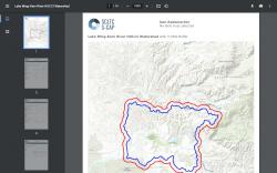
Users can save area reports as links to load or share or files to download in shapefile, Excel, and PDF formats. Land trust staff can also choose to restrict reporting to their coverage area, in cases where they want to compare a property to their coverage area.
We built the application in Python/Django, with a Postgres database and custom HTML/CSS/Javascript front end. Map data is rendered with Mapserver, and PDFs with WKHTMLtoPDF.