See This Project | Similar Projects | All Projects for Client
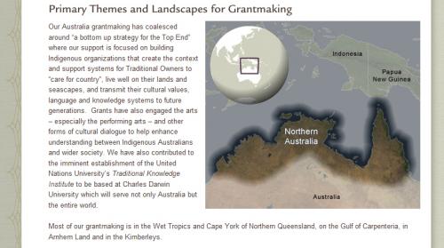
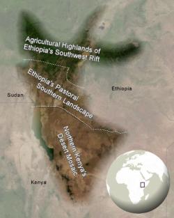
We helped the Christensen Fund prepare a series of static maps to highlight their program areas around the world.
Using Esri's ArcGIS software, we used an aerial imagery background, overlayed with a fuzzy boundary mask and reference labels. An inset globe with shading to suggest a 3D view was added with a bit of work in Photoshop. The resulting images give the viewer a sense of general project geography, suggesting that the fuzzy boundaries are not strict political delineations.
Focus: Conservation, Environment, Philanthropy
Services: GIS Services, Communications, Graphic Design, Maps, Cartography
Tags: cartography, Esri ArcGIS, foundation
Project Years: 2011