Tahoe Fund project maps

Tahoe Fund Funded Projects web map
Client:   Tahoe Fund

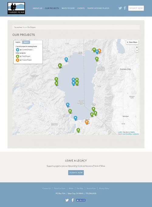
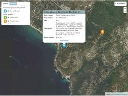
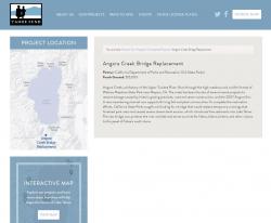
We developed an application for the Tahoe Fund that shows current, past and future projects on an interactive map. Projects can be toggled on and off, and users can search for projects by name, partner, year and type. We also developed static project maps for each individual project, that have a similar look and feel to the interactive map. 

The project map lives within the Tahoe Fund Wordpress site, and each project is linked to a project page within Wordpress. Project data, including latitude, longitude, and attributes, are stored a shared, private Google spreadsheet, which allows for easy data management and update, without the need for custom software. The interactive map itself consists of simple static HTML, CSS and JavaScript files, and is easily hosted side-by-side with the wordpress site. The map was built with the open-source Leaflet mapping API.

 The static maps were produced in an ArcGIS template, and can be readily updated over time.

Focus:   Conservation, Environment, Philanthropy  

Services:  Interactive Solutions, GIS Services, Maps, Web Mapping 

Tags:   California, Esri ArcGIS  

Project Years: 2015-2016

GreenInfo Network creates, analyzes, visualizes and communicates information in the public interest. We specialize in mapping and related technology for nonprofits and public agencies, focusing on using it for conservation, social equity, public health, environment and foundation grant making.
2201 Broadway, Suite M5
Oakland
CA
94612
United States of America