See This Project | Similar Projects | All Projects for Client
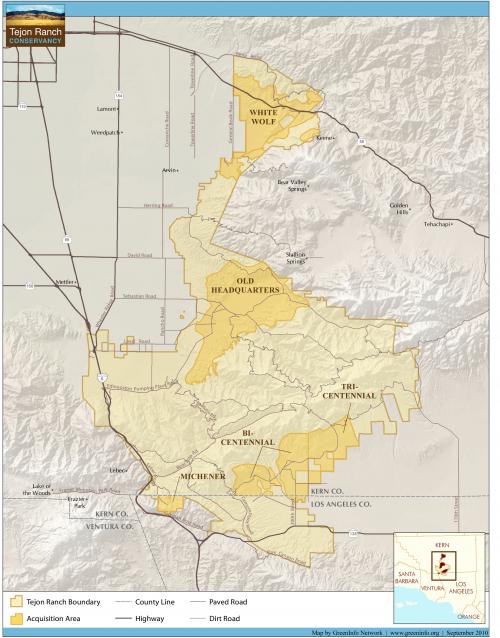
The Tejon Ranch is a 270,000 acre expanse of hills and mountains at the southern boundary of California's San Joaquin Valley, just north of Los Angeles, and is a critical habitat linkage connecting the entire southern Sierra Nevada with the Coast Range. As a condition for major urban development on the west side of the Ranch, most of the lands to the east were designated for conservation, to be managed by the Tejon Ranch Conservancy. The Conservancy asked GreenInfo to help it develop the baseline planning for one major element of the conserved areas.
The creation of the Tejon Ranch is a many-year, complex process involving major areas of urban development balanced by protection of two hundred thousand acres of landscape. A key step in this process was the acquisition of a conservation easement on 62,000 acres of the ranch in 2011, to be followed by subsequent conservation actions for the remainder. In order to secure the funding and acquisition, the Conservancy needed to prepare a management plan, and asked GreenInfo to provide the mapping needed for the plan.
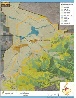
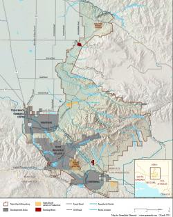
The plan is framed in three volumes and was finally adopted in 2013. The three reports included: Natural Community Descriptions; Conservation Activities and Best Management Practices; and a Public Access Plan. GreenInfo prepared over 15 maps (with many drafts along the way) help to illustrate vegetation, geology, existing conditions, future plans and numerous other aspects of the ranch to supplement the text in the reports.
The maps synthesized dozens of GIS information layers, and were designed to be exhibits in a page size format, providing much detail, but remaining visually clear to readers.
Results: The Management Plan was adopted in June 2013 by the Conservancy's board of directors and is guiding all operations on these lands.
Focus: Conservation
Services: GIS Services, Maps, Cartography
Tags: California, Esri ArcGIS, habitat, land trust, Tejon Ranch
Project Years: 2011-13