See This Project | All Projects for Client
The Public Policy Institute of California (PPIC) is a highly regarded research organization seeking to provide the best information and analysis on problems facing California. For a project on poverty in families with young children, PPIC asked GreenInfo to develop a web mapping application that would allow users to explore the geographic details of the considerable research they had conducted.
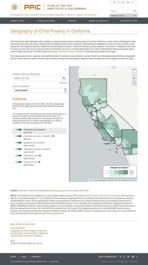
"Despite strong economic growth, California continues to struggle with high rates of child poverty. Adverse circumstances faced by young children can have long-term physical, social, and behavioral consequences—negatively affecting their future education and economic well-being. A nuanced understanding of how child poverty varies across the state would help address this challenge. In this report, we examine regional and local differences in the economic circumstances of poor families with young children age 0–5."
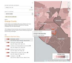
GreenInfo's challenge was to take the very rich data in the report and conceive of a web mapping application that would function inside the PPIC web site and provide users with an engaging but highly informative method of going deeper in any part of the state.
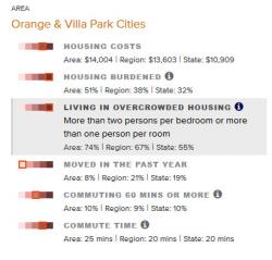
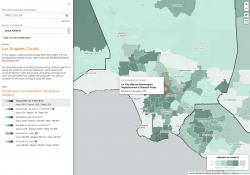
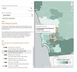
The resulting application allows users to browse the map, or to search for particular places. Six different demographic themes are available as "lenses" through which to view poverty on the map, and details on each of those are available. For each theme the map legend allows the user to choose from up to five variables, each with a narrative tailored by PPIC to contextualize the data. A full screen version of the map is also available to the user.
This is a front-end-only application built using HTML 5, CSS, and Javascript/jQuery and Leaflet. The application, which in embedded in PPIC's Wordpress site, draws its data from a linked set of spreadsheet files (in CSV format).
Focus: Human Services, Public Health, Social Justice/Equity
Services: Interactive Solutions, GIS Services, Cartography, Applications Development, Web Mapping
“ On behalf of the PPIC team, thank you for your work and guidance on this project. It’s been a pleasure, and we’re very much looking forward to sharing the fruits of your labor with the world!”
— Vicki Hsieh, Senior Editor
Project Years: 2016-17