See This Project | Similar Projects | All Projects for Client
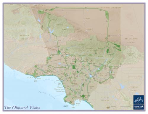
The 1930's open space vision for Los Angeles rings true nearly a century later, as the Olmsted brothers suggested a comprehensive plan to keep LA a vital and desirable community. The network of parks, greenways, beach, playgrounds, and forests comes to life in GreenInfo's comprehensive map of the plan, done for The City Project.
The Olmsted brothers were famous for planning state of the art parks and recreation areas across the United States in the 1800s and early 1900s. The Los Angeles region was thoroughly researched and given a plan by the Olmsteds in 1930, though their suggestions were largely ignored. In 2004, Lomeli and Estrada of UCLA painstakingly digitized the plans parks, greenways, parkways, reservation, beaches, forests, and school playgrounds.
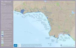
GreenInfo took the created files and created display maps of the plan. Maps detail each of the open space classification and some detail the corresponding report index - allowing one to see the entire vision while also reading the in-depth plan proposed by the Olmsted's. Maps range from large format posters to detail beach parks and access points.
The City Project has used the maps as posters, web maps and as illustrations in publications.
Results: The maps created have been used for nearly a decade to educate and inform the need for additional open space and recreation in the Los Angeles region. Many groups are working to protect the areas the Olmsteds detailed so many years ago. The comprehensive illustration of the Olmsted's vision reminds Angeleños of the beauty of their region.
Focus: Environment, Social Justice/Equity
Services: GIS Services, Analysis, Data, Maps, Cartography
Tags: California, Esri ArcGIS, Los Angeles, Olmsted
“ I think the beach map is strikingly beautiful and the full map is eloquent. It is such a pleasure to work with you and see how beautiful the results are. I am very proud of this project because of the work GreenInfo Network has done.”
— Robert Garcia, Founding Director and Counsel
Project Years: 2004-2008