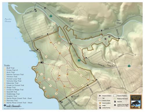
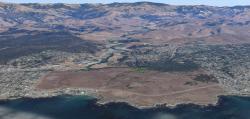
Nestled on the coast of Central California, the Fiscalini Ranch is a 437 acre gem that runs along a mile of scenic coastline, managed for public access by the nonprofit Friends of Fiscalini Ranch. Visitor programs are a main function for the Friends, who asked GreenInfo to create an improved map for their trails brochure and create a map book of the ranch and its recreational and conservation amenities.
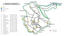
Friends of the Fiscalini Ranch Preserve came to GreenInfo Network without GIS data for the preserve. GreenInfo took what documents they had and digitized the preserve's important amenities and recreational elements, georeferencing maps and creating digital features from them. Other GIS data was created by plotting the GPS coordinates collected by the volunteer Board.
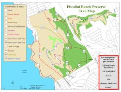
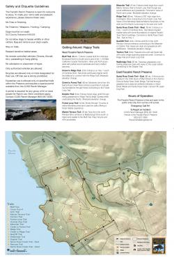
The next step was to develop a well-designed preserve map to inform visitors and inspire them to explore in the preserve. The resulting product was developed exclusively in ArcMap software and showcases access points, unique benches, the many trails, and rare Monterey Pine forests. The cartography uses a soft and evocative hillshade, with elevation contours in the preserve for extra detail. This preserve map is the main element in the new brochure for the Ranch, and will be used actively by the many visitors and in the Friends other education programs.
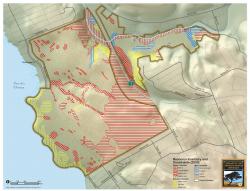
A map book of the preserve was also created with the GIS data which will be used for planning purposes by the Preserve board of directors. This resource compiles all the trail map and other resource information layers into one master PDF document, with a page for each element.
Focus: Conservation,
Environment,
Recreation
Services: GIS Services, Communications, Publications, Maps
Tags: California,
Esri ArcGIS,
land trust,
trails
“
The whole design of the map, the look, colors and layout, is perfect. It is exactly what we had hoped for -- attractive, communicates well and is easy to understand. Our board was also thrilled with the result!”
— Walt Andrus, Chair of the Board
Project Years: 2017