Trail Map Templates

Recreation Map Template: Webber Lake
Recreation and trail map template, featuring Webber Lake.
Client:   Truckee Donner Land Trust

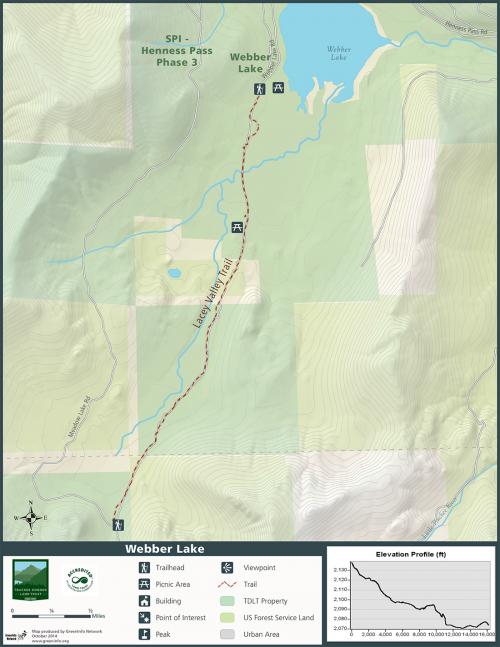
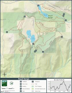
Most of the over 1,000 land trusts in the U.S. manage lands closed to public access. But for some land trusts, ensuring the people can hike on certain conserved lands is key to their mission and their public reputation. GreenInfo helped one land trust in the Lake Tahoe area of California develop some very effective GIS trail map templates that the organization can use to publish specific trail maps.

The Truckee Donner Land Trust (TDLT) is an outstanding protector of the lands north of California's Lake Tahoe.  While many of these lands are secured by easements and remain private, some are owned outright or have options for public use.  Through a project with The Martis Fund, GreenInfo worked with the land trust to improve different aspects of their GIS and mapping program, with one focus on trail maps -TDLT is frequently adding to and improving sections of their trail system, and they need to be able to update their trail maps frequently and distribute the new maps to hikers.

Using ArcMap 10.1 and 3D Analyst, GreenInfo created a GIS-based template for their trail system. From the labels to the topography, the template is designed to automate most of the map production process and display the recreation features at a variety of scales. 
In the future this will enable TDLT to quickly generate new trail maps and maintain a branded look.

Focus:   Conservation  

Services:  GIS Services, Maps, Cartography 

Tags:   California, Esri ArcGIS, Lake Tahoe, recreation, trails  

Project Years: 2014

GreenInfo Network creates, analyzes, visualizes and communicates information in the public interest. We specialize in mapping and related technology for nonprofits and public agencies, focusing on using it for conservation, social equity, public health, environment and foundation grant making.
2201 Broadway, Suite M5
Oakland
CA
94612
United States of America