See This Project | Similar Projects | All Projects for Client
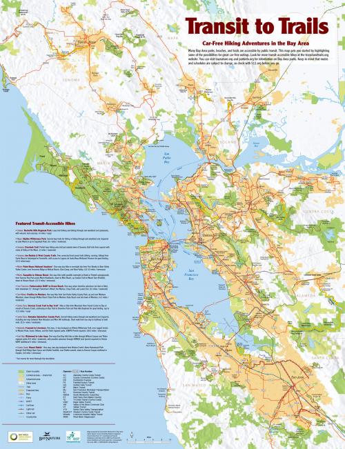
Getting people from home to parks via transit is an important challenge. For this project, GreenInfo developed a map that shows specific bus and other transit routes and was widely distributed in the San Francisco Bay region.
GreenInfo Network collaborated with the Bay Area Open Space Council and Bay Nature Magazine to develop this map showing how to use transit to get to major open spaces in the San Francisco Bay Area. The map highlights data from GreenInfo's California Protected Areas Database (CPAD) and shows major bus and other transit routes that can take visitors to these parks without need for a car. The map was created by GreenInfo's Louis Jaffe, based on GIS data organized and use for mockups by GreenInfo staff. The final art was prepared in illustration software. The map was showcased in Bay Nature magazine and updated in 2009. Tens of thousands of copies were printed and distributed by regional transit and air quality agencies.
Results: The map was successfully created and widely used by agencies promoting alternatives to cars.
Focus: Environment
Services: GIS Services, Maps
Tags: Adobe Illustrator, Bay Area, Esri ArcGIS, trails, transit
Project Years: 2006, 2009