Similar Projects | All Projects for Client
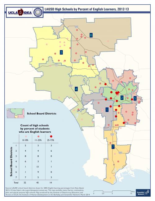
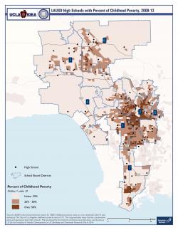
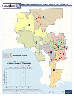
Underprivileged children are spread across many of the school board districts within Los Angeles, and PACE asked GreenInfo to develop visualizations of their situations to inform ongoing school board budget decisions.
GreenInfo prepared a series of three maps, drawing from Data Quest and American Community Survey data, to demonstrate the geographic locations with high concentrations of children in need. The maps include statistics on students who are: English learners, receiving free or reduced lunches, and/or living in poverty are best illustrated on a map.
The maps are being used by PACE to inform budgeting decisions and how to best allocate funds that assist children in need.
Focus: Education
Services: GIS Services, Data, Maps
Tags: Children, Esri ArcGIS, Los Angeles, Poverty, schools
Project Years: 2014