Similar Projects | All Projects for Client
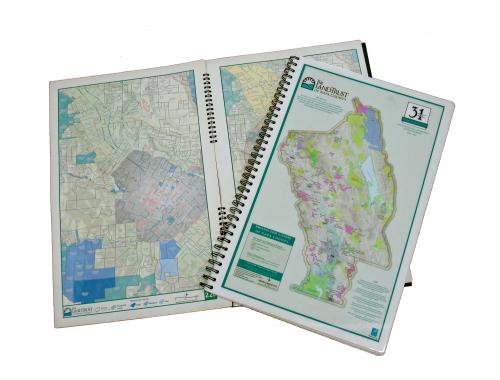
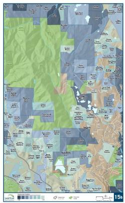
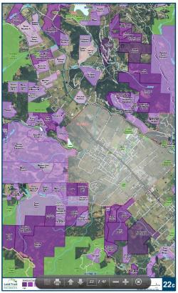
GIS technology can be used to publish extensive collections of similarly formatted maps, or atlases. GreenInfo uses this capacity to generate page, tabloid and larger sized printed documents that can be easily taken into the field or used in meetings. Atlases can show conservation, land use or demographic information, in printed or digital formats.
GreenInfo Network atlases are custom made collections of maps for a particular area. Bound with sturdy wire binding and often printed on water- and tear-proof paper, atlases can be a simple as a dozen pages or as detailed as hundreds of pages. Most atlases are page or tabloid (11"x17") in size, but some are as large as 20"x28". While web maps or onscreen images can be very useful, atlases remain indispensable for:
- Field visits to current or prospective conservation properties
- Workshops with boards or committees
- Opportunity meetings with funders, landowners or government officials
Atlases can be easily carried into the field and into meetings, and can be created as PDF booklets, for digital use and distribution. The atlas shown on this page was created for the Land Trust of Napa County, to help it easily communicate with landowners about biodiversity, farmland and open space priorities, in relation to specific ownership parcels (lines for which are on each page).
Results: The Napa Land Trust has used this atlas frequently and is reprinting an expanded version five years after the first publication. The Trust calls it "the most cost-effective and powerful mapping" they've done.
Focus: Conservation
Services: GIS Services, Maps
Tags: atlas, California, Esri ArcGIS, Napa County
“ The atlas that GreenInfo prepared for us is the single-most important tool that we use in assessing conservation values on private lands. It gives us a quick, portable and comprehensive place to begin our conversation with the landowner. It's the most cost-effective and powerful mapping that we have ever done.”
— John Hoffnagle, Executive Director of Land Trust of Napa County
Project Years: 2009-2012