Vallejo Area Watersheds

Vallejo Area Watersheds Map
This map shows watersheds, parks and related information for Vallejo,California.
Client:   Vallejo Sanitation and Flood Control District

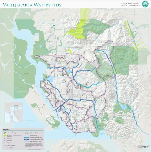
Through the years GreenInfo Network has created and updated the Vallejo Sanitation and Flood Control District map. For the 2013 update GreenInfo developed a subwatershed GIS data set for the district and produced posters for use in meetings and as educational tools throughout area schools.


Focus:   Environment, Government Agencies  

Services:  GIS Services, Maps 

Tags:   California, CPAD, Esri ArcGIS, open space, Water management, watershed  

Project Years: 2005, 2012, 2013

GreenInfo Network creates, analyzes, visualizes and communicates information in the public interest. We specialize in mapping and related technology for nonprofits and public agencies, focusing on using it for conservation, social equity, public health, environment and foundation grant making.
2201 Broadway, Suite M5
Oakland
CA
94612
United States of America